Am I at Risk?
Am I Possibly Undermined?
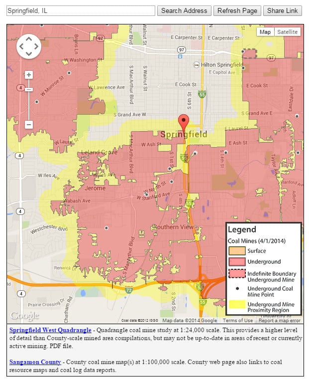
The Illinois State Geological Survey maintains the state’s largest collection of mine maps, and allows public access via the internet. In 2010, the ISGS created the Coal Mine Locator which allows the user to determine the proximity of a home or business to known coal mines and underground industrial mines. This feature is available on the ISGS website.
Map may take several seconds to load.
Please note that the accuracy and completeness of the mine maps vary, depending on the availability and quality of source material. Little or no information is available for many older mines because mining activity was not regulated or documented until the late 1800’s. Even then, reporting requirements were minimal. Also, early mine maps were often sketched by miners working in the mine at the time, or were constructed solely from memory. However, mine maps are a good source for determining if mines are present in the general area of your property.

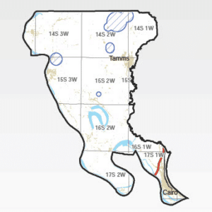
Use our interactive map to discover if your property is located in a mandatory county and if coverage will be automatically rolled on to your policy.
Interactive Illinois County Map Key:
Mine subsidence coverage is provided by your insurance company. By statute, all insurance companies writing property insurance in Illinois must provide coverage for mine subsidence. In the 34 counties in which most of the underground mining has been conducted, the statute requires mine subsidence insurance to be included in both residential and commercial policies. Coverage may be rejected in writing by the insured. These 34 mandatory counties are:
In these mandatory counties, mine subsidence insurance is automatically included in the policy. The limit for coverage for mine subsidence is generally the same as the amount of insurance for fire or windstorm, up to the statutory limit.
It is important to know that if you do not live in a mandatory county, your property may still be at risk, and you may add mine subsidence coverage to your policy by contacting your insurance agent or company. The coverage is reasonably affordable and could save you thousands of dollars in out-of-pocket repairs.
Zones of Mine Proximity as Defined by the Illinois State Geological Survey
Zone 1 includes the land over or adjacent to mines that, on the basis of the mapped extent and general depth of the mine, could be affected by subsidence.
Zone 2, which surrounds Zone 1, represents additional land that could be affected due to uncertainty about the exact location of the mine and the extent of its workings. These zones are associated only with known underground mines.
All above information has been reprinted from The Proximity of Underground Mines to Urban and Developed Lands in Illinois, 2009; Korose, Louchios, and Elrick; Illinois State Geological Survey.
Other Mine Type Risks
An additional 363 known underground mines have extracted industrial minerals and metals, including clay, fluorspar, lead, zinc, dolomite, limestone, ganister, and tripoli; all but 10 of these industrial mines have been abandoned at the time of this report. Although subsidence has occurred over all types of mines in Illinois, most subsidence is related to coal mines because of the extensive areas underlain by these mines. However, one of the state’s largest subsidence events occurred near Galena over a lead and zinc mine.
How Do I Purchase Mine Subsidence Insurance?
By statute, all insurance companies writing property insurance in Illinois must provide coverage for mine subsidence. In the 34 counties in which most of the underground mining has been conducted, the statute requires mine subsidence insurance to be included in your policy. You may reject the coverage by signing a waiver provided by your insurance company. The mandatory counties are shown in blue above. In the mandatory counties, mine subsidence insurance will be included automatically in your policy. The limit of coverage for mine subsidence is generally the same as the amount of insurance for fire or windstorm. However, insurance policy forms do vary, and there is a maximum limit established by regulation. Review your policy or check with your insurance agent or company to confirm the limit for mine subsidence insurance on your property. If your property is located in one of the remaining non-mandatory counties, you may add mine subsidence coverage to your insurance policy by contacting your insurance agent or company.
